

TOPOPHYTE
Concept study for the San Francisco Bay Trail. 2012
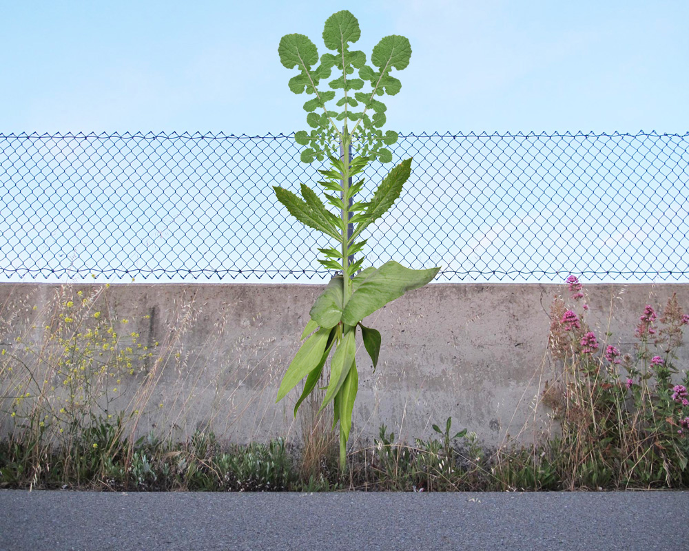
By merging the features of the individual plant species in a given habitat into a single imaginary meta-plant, a composite portrait of the habitat is produced - a kind of pictorial ecotope. This is done in a way that is not just an arbitrary botanical collage but is instead a precise transect or biogeographic map that reflects the spatial distribution as well as the species composition of the habitat. The result can be thought of as kind of visual “topophyte” - place plant, or “cartophyte” - map plant.

The semi-natural landscapes that arise around transit routes, commercial zones, residential developments, and urban centers are usually populated with introduced plant species that thrive in the biologically challenging conditions of human-engineered infrastructure. These weedy parawilds are often regarded as mundane and uninteresting or seen as regrettable “subnatures” - the unintended and undesirable byproducts of human landscape alteration.
Closer examination reveals complex, highly adaptive ecologies that reflect the diverse topography, soils, watersheds, and microclimates arising in these new and rapidly proliferating melds of anthrogenic and natural terrain . Playing off the binaries of exotic/mundane, real/imaginary, ordinary/ extraordinary, the topophyte concept functions as a taxonomic entry point into a more animated botanical understanding of these hybrid environments.
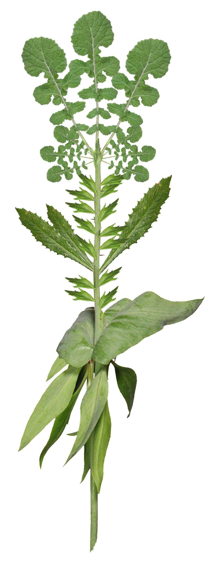
In the example shown, the topophyte illustration is composed of three broadleaf herbaceous plants of Mediterranean origin: Black Mustard, Bristly Ox Tongue, and Red Valerian. It also includes a native species: California Mugwort. Images of the leaves of each plant are arranged along a stem axis in the same sequential order as they occur in a given botanical habitat, creating a spatial plant identification transect.

Topophyte illustration, plant identification guides, and trail maps can be connected to specific botanical transects through the use of embedded geodetic survey markers in a trail marking system that link sites to digital or print media.

